

Files
Download Full Text (1.6 MB)
Description
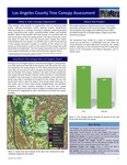
This project applied the USDA Forest Service’s Tree Canopy Assessment protocols to the City of Los Angeles. The analysis was conducted using imagery and LiDAR acquired in 2016 provided through the Los Angeles Region Imagery Acquisition Consortium program.
The assessment was funded by a grant to TreePeople and carried out by SavATree in collaboration with the Center for Urban Resilience at Loyola Marymount University, the Spatial Analysis Laboratory at the University of Vermont’s Rubenstein School of the Environment and Natural Resources, and Dr. Dexter Locke.
Publication Date
4-24-2019
Recommended Citation
Galvin, Mike; O’Neil‐Dunne, Jarlath; Locke, Dexter; and Romolini, Michele, "Los Angeles County Tree Canopy Assessment" (2019). Center for Urban Resilience Reports. 5.
https://digitalcommons.lmu.edu/cures_reports/5